
1956 Map of Coleen B-2
USGS Topo · Published 1959About this map
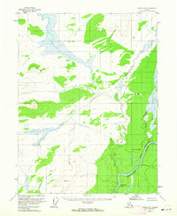
The Porcupine River carves a deep path through the southeastern corner of this Alaskan interior landscape, flowing through the Upper Ramparts where the terrain tightens. Surveyed in the mid-1950s using photogrammetric methods from 1955 aerial photography, the map documents a region defined by its hydrography and high-altitude survey points rather than human settlement. The Rapid River and Howling Dog Creek drain the north and south respectively, feeding toward the larger river systems. Geodetic markers such as Rapid North Base and VABM 1823 Howling provide precise reference points across a landscape devoid of roads or established trails. Distinctive landmarks like Half-way Pillar along the riverbanks serve as essential navigation aids for those traversing this portion of the Yukon-Koyukuk region.
Find a feature on this map
9 named features on this map. Tap any name to fly to it.
Don’t see what you’re looking for? This feature index may not catch every label — zoom into the map to look around manually.
Map Details
Editions of this 1956 Coleen B-2 Map
2 editions found
Other maps of this area

1951 · Coleen
USGS Topo · 1:250,000

1956 · Coleen
USGS Topo · 1:250,000
1956 · Coleen B-1
USGS Topo · 1:63,360

1956 · Coleen A-1
USGS Topo · 1:63,360

1956 · Coleen A-3
USGS Topo · 1:63,360

1956 · Coleen A-2
USGS Topo · 1:63,360
1990 · Coleen C-2
USGS Topo · 1:63,360
1990 · Coleen C-1
USGS Topo · 1:63,360
1990 · Coleen B-3
USGS Topo · 1:63,360
1990 · Coleen C-3
USGS Topo · 1:63,360