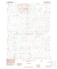
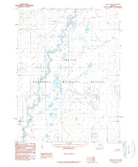
1990 Map of Coleen B-3
USGS Topo · Published 1990About this map
Rabbit Mountain stands as the primary geographic landmark in this remote northern interior of the Brooks Range foothills. Drawn from aerial photography taken in 1978, the landscape shows the high-latitude drainage systems of Fish Creek as it winds through a terrain defined by stark topographic contours. The entire quadrangle is encompassed within the Arctic National Wildlife Refuge, a designation formally established just after the aerial survey by the Alaska National Interest Lands Conservation Act. The map captures a moment of transition for this wilderness area, documenting its elevation and watercourses as they were officially organized under federal management in the late 20th century.
Find a feature on this map
3 named features on this map. Tap any name to fly to it.
Don’t see what you’re looking for? This feature index may not catch every label — zoom into the map to look around manually.
Map Details
Editions of this 1990 Coleen B-3 Map
This is the sole edition of this map. No revisions or reprints were ever made.
Other maps of this area

1951 · Coleen
USGS Topo · 1:250,000

1956 · Coleen
USGS Topo · 1:250,000

1956 · Coleen B-2
USGS Topo · 1:63,360

1956 · Coleen A-3
USGS Topo · 1:63,360

1956 · Coleen A-4
USGS Topo · 1:63,360

1956 · Coleen A-2
USGS Topo · 1:63,360
1990 · Coleen C-2
USGS Topo · 1:63,360
1990 · Coleen C-4
USGS Topo · 1:63,360
1990 · Coleen C-3
USGS Topo · 1:63,360
1990 · Coleen B-4
USGS Topo · 1:63,360