
1956 Map of Black River D-4
USGS Topo · Published 1959About this map
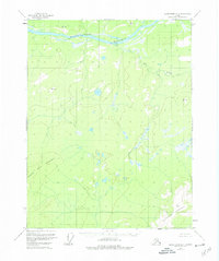
The Porcupine River flows through the northern reaches of this Alaskan interior landscape, cutting through the distinctive geological formation known as the Lower Ramparts. Mapped in the mid-1950s using aerial photography, the terrain is defined by dramatic elevations including Frozen Calf Mountain in the west and the soaring heights of Niggerhead Mountain to the southeast.
Find a feature on this map
11 named features on this map. Tap any name to fly to it.
Don’t see what you’re looking for? This feature index may not catch every label — zoom into the map to look around manually.
Map Details
Editions of this 1956 Black River D-4 Map
4 editions found
Other maps of this area

1951 · Black River
USGS Topo · 1:250,000

1951 · Coleen
USGS Topo · 1:250,000

1956 · Coleen
USGS Topo · 1:250,000

1956 · Black River D-3
USGS Topo · 1:63,360

1956 · Coleen A-5
USGS Topo · 1:63,360

1956 · Black River D-5
USGS Topo · 1:63,360

1956 · Coleen A-3
USGS Topo · 1:63,360

1956 · Black River C-5
USGS Topo · 1:63,360

1956 · Black River C-4
USGS Topo · 1:63,360

1956 · Coleen A-4
USGS Topo · 1:63,360