
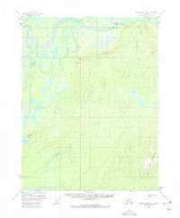
1956 Map of Black River D-5
USGS Topo · Published 1959About this map
The Porcupine River carves through this northern landscape, defining the northern edge of a wilderness marked by complex waterways and isolated heights. Along its banks, John Herberts Village serves as a lone human outpost, while nearby Graphite Pt and Deacons Rock stand as notable navigational markers for river travelers. To the south, the terrain rises toward the significant peak of Frozen Calf Mountain, which anchors the lower-right quadrant of the sheet. Between the river and the mountains, a network of wetlands and seasonal water features like Henderson Slough and Fishhook Creek dominate the interior. A single Tractor Trail provides a rare terrestrial route through the western brush, passing by Wolverine Lake and Scotty Lake. This map records a time when Arctic transport was still largely dictated by the seasonal flow of the river and a few overland trails.
Find a feature on this map
14 named features on this map. Tap any name to fly to it.
Don’t see what you’re looking for? This feature index may not catch every label — zoom into the map to look around manually.
Map Details
Editions of this 1956 Black River D-5 Map
2 editions found
Other maps of this area

1951 · Black River
USGS Topo · 1:250,000

1951 · Coleen
USGS Topo · 1:250,000

1956 · Coleen
USGS Topo · 1:250,000

1956 · Black River D-6
USGS Topo · 1:63,360

1956 · Coleen A-5
USGS Topo · 1:63,360

1956 · Black River D-4
USGS Topo · 1:63,360

1956 · Black River C-6
USGS Topo · 1:63,360
1956 · Coleen A-6
USGS Topo · 1:63,360

1956 · Black River C-5
USGS Topo · 1:63,360

1956 · Black River C-4
USGS Topo · 1:63,360