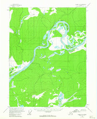
1956 Map of Coleen A-3
USGS Topo · Published 1963About this map
The Porcupine River carves a dramatic path through the Alaskan interior, serving as the primary geographic feature and transportation artery in this subarctic landscape. Near the eastern edge of the map, Canyon Village sits along the riverbanks, representing the primary point of human settlement in a region characterized by complex water systems and seasonal islands. The river is defined by sharp geographic markers such as the large oxbow at Fishhook Bend, which encircles Henry Martin Island. Further south, a solitary Cabin and numerous survey markers like Vabm 2268 indicate the sparse but present human imprint on the land during the mid-1950s. The intricate network of smaller tributaries, including Fish Creek, feeds into the main river channel, creating a landscape of marshes and fluctuating waterways essential for local travel and subsistence.
Find a feature on this map
10 named features on this map. Tap any name to fly to it.
Don’t see what you’re looking for? This feature index may not catch every label — zoom into the map to look around manually.
Map Details
Editions of this 1956 Coleen A-3 Map
2 editions found
Other maps of this area

1951 · Black River
USGS Topo · 1:250,000

1951 · Coleen
USGS Topo · 1:250,000

1956 · Coleen
USGS Topo · 1:250,000

1956 · Coleen B-2
USGS Topo · 1:63,360

1956 · Black River D-3
USGS Topo · 1:63,360

1956 · Black River D-4
USGS Topo · 1:63,360

1956 · Coleen A-3
USGS Topo · 1:63,360

1956 · Black River D-2
USGS Topo · 1:63,360

1956 · Coleen A-4
USGS Topo · 1:63,360

1956 · Coleen A-2
USGS Topo · 1:63,360