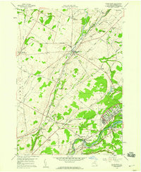
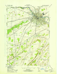
1958 Map of Black River
USGS Topo · Published 1960About this map
The Black River flows along the southern boundary of this region, providing the namesake for the settlement of Black River and the industrial activity at Felts Mills. In the late 1950s, the landscape is defined by the significant footprint of the U S Military Reservation Camp Drum, which occupies much of the eastern terrain. This military presence sits in contrast to the surrounding rural hamlets and agricultural corners, such as Dutch Settlement and Pamelia Four Corners.
Find a feature on this map
69 named features on this map. Tap any name to fly to it.
Don’t see what you’re looking for? This feature index may not catch every label — zoom into the map to look around manually.
Map Details
Editions of this 1958 Black River Map
4 editions found
Other maps of this area

1895 · Watertown
USGS Topo · 1:62,500

1898 · Watertown
USGS Topo · 1:62,500

1902 · Carthage
USGS Topo · 1:62,500

1903 · Theresa
USGS Topo · 1:62,500

1904 · Carthage
USGS Topo · 1:62,500

1908 · Watertown
USGS Topo · 1:62,500

1909 · Watertown
USGS Topo · 1:62,500

1911 · Antwerp
USGS Topo · 1:62,500

1942 · Copenhagen
USGS Topo · 1:24,000
1943 · Watertown
USGS Topo · 1:31,680