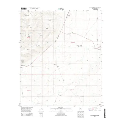
2013 Map of Black River Village
USGS Topo · Published 2013About this map
Black River Village and the surrounding ranchlands of Eddy County are depicted here in the high desert landscape of southeastern New Mexico. The terrain is defined by a network of drainage systems including Cass Draw, Threemile Draw, and the prominent Goat Corral Canyon. Human activity is centered around established cattle operations and rural settlements, with names like Judkins Ranch, Old Pardue Ranch, and Sims Ranch illustrating the long-standing agricultural history of the region.
Find a feature on this map
46 named features on this map. Tap any name to fly to it.
Don’t see what you’re looking for? This feature index may not catch every label — zoom into the map to look around manually.
Map Details
Editions of this 2013 Black River Village Map
This is the sole edition of this map. No revisions or reprints were ever made.
Other maps of this area

1939 · Carlsbad
USGS Topo · 1:62,500

1943 · Carlsbad
USGS Topo · 1:62,500

1943 · West Carlsbad
USGS Topo · 1:62,500

1945 · West Carlsbad
USGS Topo · 1:62,500

1945 · Carlsbad Caverns East
USGS Topo · 1:62,500

1945 · Malaga
USGS Topo · 1:62,500

1946 · Malaga
USGS Topo · 1:62,500

1947 · Carlsbad Caverns East
USGS Topo · 1:62,500

1954 · Carlsbad
USGS Topo · 1:250,000

1958 · Carlsbad
USGS Topo · 1:250,000