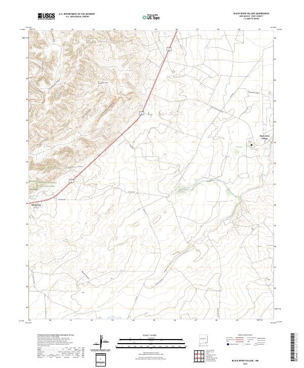
2023 Map of Black River Village
USGS Topo · Published 2023About this map
Guadalupe Ridge and the Frontier Hills dominate this portion of the Chihuahuan Desert landscape, where the transition from high ridgelines to alluvial draws defines the local geography. The eastern edge of Carlsbad Caverns National Park is visible, marking the boundary between federally protected wilderness and the working lands of Eddy County. Small settlements and springs provide the primary evidence of human habitation in this arid environment, with Whites City serving as a gateway at the intersection of Whites City Rd and the main highway corridor. To the east, Black River Village sits near the headwaters of the Threemile Draw, where water sources like Blue Spring and Castle Spring were historically vital for livestock and early ranching operations. Significant draws including Elbow Canyon, Jurnigan Draw, and Walnut Canyon illustrate the complex drainage patterns leading away from the mountains toward the Black River basin.
Find a feature on this map
30 named features on this map. Tap any name to fly to it.
Don’t see what you’re looking for? This feature index may not catch every label — zoom into the map to look around manually.
Map Details
Editions of this 2023 Black River Village Map
This is the sole edition of this map. No revisions or reprints were ever made.
Other maps of this area

1939 · Carlsbad
USGS Topo · 1:62,500

1943 · Carlsbad
USGS Topo · 1:62,500

1943 · West Carlsbad
USGS Topo · 1:62,500

1945 · West Carlsbad
USGS Topo · 1:62,500

1945 · Carlsbad Caverns East
USGS Topo · 1:62,500

1945 · Malaga
USGS Topo · 1:62,500

1946 · Malaga
USGS Topo · 1:62,500

1947 · Carlsbad Caverns East
USGS Topo · 1:62,500

1954 · Carlsbad
USGS Topo · 1:250,000

1958 · Carlsbad
USGS Topo · 1:250,000