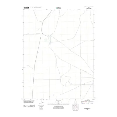
2010 Map of Black Rock
USGS Topo · Published 2010About this map
Black Rock and Malone sit within a high-desert landscape defined by scarce water sources and long-distance desert tracks in western Utah. This 2010 survey illustrates the vital importance of groundwater in the region, centered on the Black Rock Well and a cluster of nearby springs including Tie House Spring, Big Spring, and Alkali Spring. The intermittent Beaver River and Cove Creek cross the terrain, their ephemeral nature contrasted by the grid-like precision of local roads such as Black Rock Rd and S 24300 West St. This area reflects a quiet ranching or transit character where named seeps like Kaufman Seep remain essential landmarks for navigation and land use in an otherwise arid expanse of Millard County.
Find a feature on this map
18 named features on this map. Tap any name to fly to it.
Don’t see what you’re looking for? This feature index may not catch every label — zoom into the map to look around manually.
Map Details
Editions of this 2010 Black Rock Map
This is the sole edition of this map. No revisions or reprints were ever made.
Other maps of this area

1885 · Beaver
USGS Topo · 1:250,000

1953 · Richfield
USGS Topo · 1:250,000

1958 · Richfield
USGS Topo · 1:250,000

1960 · Beaver Lake Mts.
USGS Topo · 1:62,500

1972 · Headlight Mtn
USGS Topo · 1:24,000

1973 · Cruz
USGS Topo · 1:24,000

1973 · Pinnacle Pass
USGS Topo · 1:24,000

1973 · Antelope Spring
USGS Topo · 1:24,000

1973 · Black Rock
USGS Topo · 1:24,000

1973 · Read
USGS Topo · 1:24,000