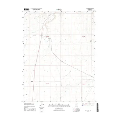
2014 Map of Black Rock
USGS Topo · Published 2014About this map
Black Rock sits as a lonely outpost within the wide expanse of Millard County, where the desert landscape is defined more by its vital water sources than its sparse settlements. This 2014 survey traces the path of the Beaver River and Cove Cr as they move through the arid environment, feeding into the Beaver Bottoms. The map provides an essential record of local hydrography, identifying specific springs like The House Spring, Big Spring, and the uniquely named Wolfman Seep. These water points were historical lifelines for travelers and early inhabitants traversing the Escalante Desert. To the south, the settlement of Malone appears near the intersection of several section-line roads, such as W 15300 S. The layout of the region reveals a transition from natural landmarks to modern infrastructure, highlighted by the presence of the Energy Corridor Rd and Crystal Peak Rd, which slice through the traditional township boundaries of T24S and T25S.
Find a feature on this map
25 named features on this map. Tap any name to fly to it.
Don’t see what you’re looking for? This feature index may not catch every label — zoom into the map to look around manually.
Map Details
Editions of this 2014 Black Rock Map
This is the sole edition of this map. No revisions or reprints were ever made.
Other maps of this area

1885 · Beaver
USGS Topo · 1:250,000

1953 · Richfield
USGS Topo · 1:250,000

1958 · Richfield
USGS Topo · 1:250,000

1960 · Beaver Lake Mts.
USGS Topo · 1:62,500

1972 · Headlight Mtn
USGS Topo · 1:24,000

1973 · Cruz
USGS Topo · 1:24,000

1973 · Pinnacle Pass
USGS Topo · 1:24,000

1973 · Antelope Spring
USGS Topo · 1:24,000

1973 · Black Rock
USGS Topo · 1:24,000

1973 · Read
USGS Topo · 1:24,000