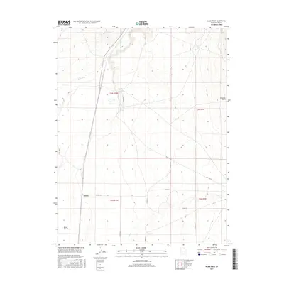
2017 Map of Black Rock
USGS Topo · Published 2017About this map
The arid drainage of the Beaver River dominates this landscape in southwestern Millard County, where seasonal water sources and desert terrain meet. The settlement of Malone sits at a junction of early section roads, including W 15300 S St, marking a point of human habitation in a region otherwise characterized by vast stretches of the Escalante Desert. To the north, a cluster of vital desert water sources such as Big Spring, Alkali Spring, and The House Spring emerge near the riverbed, highlighting the critical nature of these features for ranching and survival in the high desert. To the south, the Beaver Bottoms and the channel of Cove Cr indicate a topography shaped by intermittent flows, while a network of surveyed roads like Black Rock Rd provides the modern framework for traversing this historically isolated terrain.
Find a feature on this map
22 named features on this map. Tap any name to fly to it.
Don’t see what you’re looking for? This feature index may not catch every label — zoom into the map to look around manually.
Map Details
Editions of this 2017 Black Rock Map
This is the sole edition of this map. No revisions or reprints were ever made.
Other maps of this area

1885 · Beaver
USGS Topo · 1:250,000

1953 · Richfield
USGS Topo · 1:250,000

1958 · Richfield
USGS Topo · 1:250,000

1960 · Beaver Lake Mts.
USGS Topo · 1:62,500

1972 · Headlight Mtn
USGS Topo · 1:24,000

1973 · Cruz
USGS Topo · 1:24,000

1973 · Pinnacle Pass
USGS Topo · 1:24,000

1973 · Antelope Spring
USGS Topo · 1:24,000

1973 · Black Rock
USGS Topo · 1:24,000

1973 · Read
USGS Topo · 1:24,000