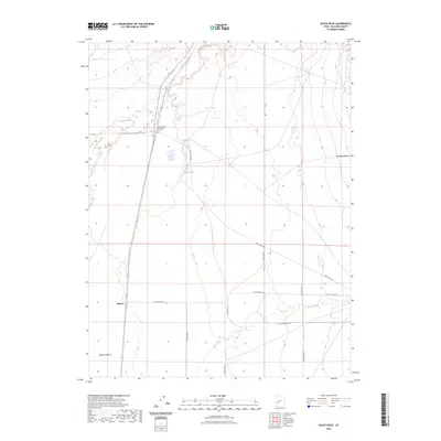
2023 Map of Black Rock
USGS Topo · Published 2023About this map
Margaret Sue Carrington Grave sits as a solitary landmark in this arid reach of Millard County, marking a specific point of family history amidst the desert landscape. The western portion of the map is defined by the winding course of the Beaver River and the low-lying Beaver Bottoms, which contrast with the wide expanse of the Escalante Desert to the east. Sparse water sources such as Kaufman Seep, The House Spring, and Alkali Spring underscore the critical importance of localized hydrology in this environment. The settlement of Malone and a network of desert routes, including Black Rock Rd, connect the few features of this open terrain, where Cove Creek cuts through the southeastern quadrant.
Find a feature on this map
19 named features on this map. Tap any name to fly to it.
Don’t see what you’re looking for? This feature index may not catch every label — zoom into the map to look around manually.
Map Details
Editions of this 2023 Black Rock Map
This is the sole edition of this map. No revisions or reprints were ever made.
Other maps of this area

1885 · Beaver
USGS Topo · 1:250,000

1953 · Richfield
USGS Topo · 1:250,000

1958 · Richfield
USGS Topo · 1:250,000

1960 · Beaver Lake Mts.
USGS Topo · 1:62,500

1972 · Headlight Mtn
USGS Topo · 1:24,000

1973 · Cruz
USGS Topo · 1:24,000

1973 · Pinnacle Pass
USGS Topo · 1:24,000

1973 · Antelope Spring
USGS Topo · 1:24,000

1973 · Black Rock
USGS Topo · 1:24,000

1973 · Read
USGS Topo · 1:24,000