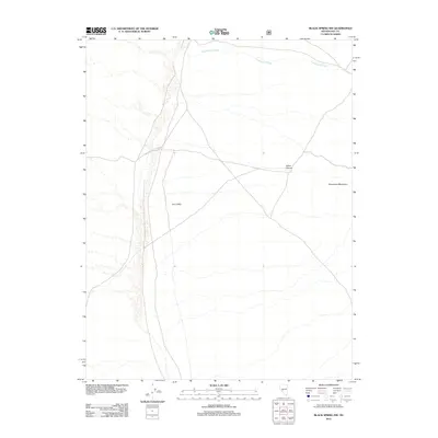
2012 Map of Black Spring NW
USGS Topo · Published 2012About this map
Ione Valley dominates this arid landscape in Nye County, showing the intricate drainage patterns that define the eastern slopes of the Shoshone Mountains. The map traces the intermittent course of Cottonwood Creek as it winds through the northern portion of the quadrangle, highlighting the natural topographical features of the Great Basin. This 2012 survey illustrates the relationship between the elevated terrain of Indian Canyon and the broad alluvial basins typical of central Nevada. For those interested in the geographic character of the region, the document provides a precise representation of the high-desert environment and its sparse water features in the early 21st century.
Find a feature on this map
4 named features on this map. Tap any name to fly to it.
Don’t see what you’re looking for? This feature index may not catch every label — zoom into the map to look around manually.
Map Details
Editions of this 2012 Black Spring NW Map
This is the sole edition of this map. No revisions or reprints were ever made.
Other maps of this area

1907 · Tonopah
USGS Topo · 1:250,000

1908 · Tonopah
USGS Topo · 1:250,000

1948 · Paradise Peak
USGS Topo · 1:62,500

1948 · Ione
USGS Topo · 1:62,500

1950 · Paradise Peak
USGS Topo · 1:62,500

1950 · Ione
USGS Topo · 1:62,500

1956 · Tonopah
USGS Topo · 1:250,000

1959 · Tonopah
USGS Topo · 1:250,000

1962 · Tonopah
USGS Topo · 1:250,000
1979 · Goldyke
USGS Topo · 1:24,000