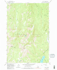
1963 Map of Black Tip
USGS Topo · Published 1983About this map
Upper Payette Lake and its northern tributaries anchor this high-elevation Idaho landscape, which was photo-inspected in 1979 to confirm the topography mapped in the early 1960s. The area is defined by the sharp divide of Center Ridge and the volcanic namesake of Lava Ridge, falling within the protected bounds of the Payette National Forest. This survey documents the remote headwaters of the North Fork Payette River and its interaction with the Idaho County and Valley County line. Alpine features such as Black Tip and Bruin Mtn overlook a series of glacial basins containing Kenneth Lake, Scribner Lake, and the French Creek Lakes. Historical access is indicated by the Upper Payette Campground and the Fisher Creek Saddle, marking the movement of forest travelers through the drainage networks of Little French Creek and Deep Creek.
Find a feature on this map
35 named features on this map. Tap any name to fly to it.
Don’t see what you’re looking for? This feature index may not catch every label — zoom into the map to look around manually.
Map Details
Editions of this 1963 Black Tip Map
3 editions found
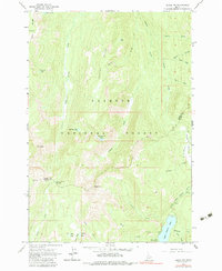
Other maps of this area

1938 · Riggins
USGS Topo · 1:96,000

1945 · Riggins
USGS Topo · 1:125,000

1955 · Grangeville
USGS Topo · 1:250,000

1956 · Burgdorf
USGS Topo · 1:62,500

1956 · Elk City
USGS Topo · 1:250,000

1959 · Grangeville
USGS Topo · 1:250,000

1960 · Elk City
USGS Topo · 1:250,000

1963 · Granite Lake
USGS Topo · 1:24,000

1963 · Black Tip
USGS Topo · 1:24,000

1963 · Hershey Point
USGS Topo · 1:24,000