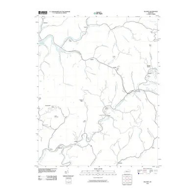
2010 Map of Blackey
USGS Topo · Published 2010About this map
Rockhouse Creek and its many tributaries define the landscape of this eastern Kentucky region, where small mountain communities are connected by winding hollow roads. The southern portion of the map is anchored by the settlement of Blackey, situated along the North Fork Kentucky River, while the northern section features the waters of Carr Fork Lake. This area is notable for its dense network of family and local cemeteries, including James D Caudill Cemetery, Christon Cemetery, and Combs Cemetery, providing a detailed record for genealogists tracing ancestral roots in Letcher and Knott counties. Distinctive local names like Carbon Glow, Hot Spot, and Carcassonne indicate the historical importance of the region's mining and cultural identities. The presence of multiple active post offices, such as those in Isom and Jeremiah, highlights the enduring nature of these rural Appalachian crossroads.
Find a feature on this map
94 named features on this map. Tap any name to fly to it.
Don’t see what you’re looking for? This feature index may not catch every label — zoom into the map to look around manually.
Map Details
Editions of this 2010 Blackey Map
This is the sole edition of this map. No revisions or reprints were ever made.
Other maps of this area

1890 · Whitesburg
USGS Topo · 1:125,000

1891 · Hazard
USGS Topo · 1:125,000

1892 · Whitesburg
USGS Topo · 1:125,000

1912 · Hindman
USGS Topo · 1:48,000

1913 · Oven Fork
USGS Topo · 1:48,000

1914 · Troublesome
USGS Topo · 1:62,500

1915 · Hindman
USGS Topo · 1:62,500

1915 · Whitesburg
USGS Topo · 1:62,500

1916 · Cornettsville
USGS Topo · 1:62,500
1935 · Pardee
USGS Topo · 1:24,000