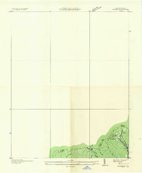
1935 Map of Pardee
USGS Topo · Published 1935About this map
Pardee and its surrounding coal infrastructure dominate this corner of the Cumberland Mountains during the mid-1930s. The settlement is defined by the heavy presence of the Pardee Mines and the Old Dominion Power Company, which maintained a significant Power Transmission Line through the rugged terrain of Black Mountain. This survey serves as a focused industrial study of the Kentucky Virginia border region, documenting the vital connections between extraction points and the local community. Beyond the mines, local life centers on the Pardee Ch and routes like State Highway No 69. The map also traces the natural drainages of the area, including Mud Lick Creek and the deep incision of Band Mill Hollow, illustrating the narrow valleys where Appalachian industry and homesteads converged.
Find a feature on this map
14 named features on this map. Tap any name to fly to it.
Don’t see what you’re looking for? This feature index may not catch every label — zoom into the map to look around manually.
Map Details
Editions of this 1935 Pardee Map
This is the sole edition of this map. No revisions or reprints were ever made.
Other maps of this area

1890 · Whitesburg
USGS Topo · 1:125,000

1892 · Whitesburg
USGS Topo · 1:125,000

1894 · Estillville
USGS Topo · 1:125,000

1912 · Pound
USGS Topo · 1:48,000

1913 · Oven Fork
USGS Topo · 1:48,000

1914 · Pound
USGS Topo · 1:62,500

1915 · Whitesburg
USGS Topo · 1:62,500

1920 · Wise
USGS Topo · 1:48,000

1921 · Big Stone Gap
USGS Topo · 1:48,000

1921 · Wise
USGS Topo · 1:62,500