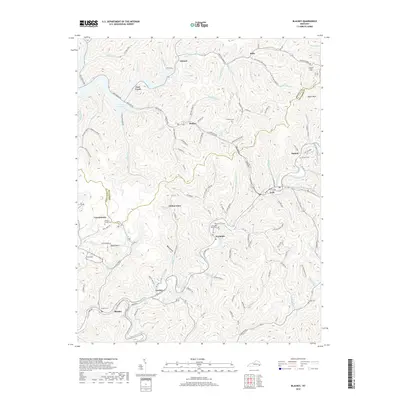
2019 Map of Blackey
USGS Topo · Published 2019About this map
Blackey and the winding course of Rockhouse Creek anchor this section of the Kentucky coalfields, where the border between Letcher Co and Knott Co follows the high ridgelines. The landscape is defined by its deep hollows and narrow valleys, such as Back Hollow and Pauley Hollow Rd, which contain many of the area's small communities and family landmarks. Settlement patterns here are dictated by the terrain, with homes and local roads tracing the paths of waterways like Bull Cr and Defeated Cr.
Find a feature on this map
118 named features on this map. Tap any name to fly to it.
Don’t see what you’re looking for? This feature index may not catch every label — zoom into the map to look around manually.
Map Details
Editions of this 2019 Blackey Map
This is the sole edition of this map. No revisions or reprints were ever made.
Other maps of this area

1890 · Whitesburg
USGS Topo · 1:125,000

1891 · Hazard
USGS Topo · 1:125,000

1892 · Whitesburg
USGS Topo · 1:125,000

1912 · Hindman
USGS Topo · 1:48,000

1913 · Oven Fork
USGS Topo · 1:48,000

1914 · Troublesome
USGS Topo · 1:62,500

1915 · Hindman
USGS Topo · 1:62,500

1915 · Whitesburg
USGS Topo · 1:62,500

1916 · Cornettsville
USGS Topo · 1:62,500
1935 · Pardee
USGS Topo · 1:24,000