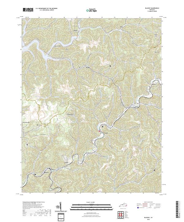
2022 Map of Blackey
USGS Topo · Published 2022About this map
Blackey and Letcher sit at the southern edge of this study of eastern Kentucky's coal country, where the landscape is defined by the winding course of the North Fork Kentucky River. The map documents a deeply dissected terrain of narrow hollows and steep ridges, such as Dikson Mtn, that have long shaped the settlement patterns of Knott and Letcher counties. Smaller communities like Carbon Glow, Jeremiah, and Carcassonne are reached by winding roads like Carcassonne Rd and State Hwy 2036.
Find a feature on this map
99 named features on this map. Tap any name to fly to it.
Don’t see what you’re looking for? This feature index may not catch every label — zoom into the map to look around manually.
Map Details
Editions of this 2022 Blackey Map
This is the sole edition of this map. No revisions or reprints were ever made.
Other maps of this area

1890 · Whitesburg
USGS Topo · 1:125,000

1891 · Hazard
USGS Topo · 1:125,000

1892 · Whitesburg
USGS Topo · 1:125,000

1912 · Hindman
USGS Topo · 1:48,000

1913 · Oven Fork
USGS Topo · 1:48,000

1914 · Troublesome
USGS Topo · 1:62,500

1915 · Hindman
USGS Topo · 1:62,500

1915 · Whitesburg
USGS Topo · 1:62,500

1916 · Cornettsville
USGS Topo · 1:62,500
1935 · Pardee
USGS Topo · 1:24,000