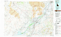
1978 Map of Blackfoot
USGS Topo · Published 1997About this map
The Snake River and its intricate canal systems define the agricultural heart of this Eastern Idaho region during the late 1970s. This survey details the complex water management network essential to the valley, including the Aberdeen Canal, Peoples Canal, and Reservation Canal. To the west, the landscape shifts abruptly into the volcanic terrain of Hells Half Acre and the expansive Idaho National Engineering Laboratory site, where the small settlement of Atomic City sits on the edge of the basalt flows.
Find a feature on this map
89 named features on this map. Tap any name to fly to it.
Don’t see what you’re looking for? This feature index may not catch every label — zoom into the map to look around manually.
Map Details
Editions of this 1978 Blackfoot Map
This is the sole edition of this map. No revisions or reprints were ever made.
Other maps of this area

1917 · Portneuf
USGS Topo · 1:62,500

1918 · Paradise Valley
USGS Topo · 1:62,500

1924 · Ammon
USGS Topo · 1:62,500

1934 · American Falls
USGS Topo · 1:62,500

1934 · Michaud
USGS Topo · 1:62,500

1936 · American Falls
USGS Topo · 1:62,500

1937 · Pocatello
USGS Topo · 1:48,000

1937 · Michaud
USGS Topo · 1:62,500

1940 · Blackfoot
USGS Topo · 1:62,500

1943 · Blackfoot
USGS Topo · 1:62,500