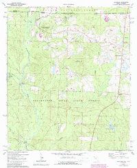
1973 Map of Blackman
USGS Topo · Published 1987About this map
The Blackwater River State Forest dominates this northern Florida landscape, where the dense creek networks of the Panhandle meet the Alabama state line. The Blackwater River snakes through the western half of the map, fed by numerous tributaries including Hurricane Creek and Panther Creek. This 1970s survey captures a transition in the forest's utility, showing established recreational spots like Karick Lake with its Campground and Boat Ramp alongside active landmarks like the Sand Hill Lookout Tower. Local community life is centered around small rural settlements and religious sites such as Red Oak Church and Olive Branch Church. The map also details early infrastructure like the Pipelines corridor in the southwest and several river crossings including Kennedy Bridge and Peaden Bridge, which were vital for connecting isolated agricultural pockets like Escambia Farms and Good Hope to the wider region.
Find a feature on this map
47 named features on this map. Tap any name to fly to it.
Don’t see what you’re looking for? This feature index may not catch every label — zoom into the map to look around manually.
Map Details
Editions of this 1973 Blackman Map
3 editions found
Other maps of this area

1948 · Munson
USGS Topo · 1:62,500

1949 · Crestview
USGS Topo · 1:62,500

1950 · Munson
USGS Topo · 1:62,500

1951 · Crestview
USGS Topo · 1:62,500

1953 · Andalusia
USGS Topo · 1:250,000

1957 · Andalusia
USGS Topo · 1:250,000

1957 · Pensacola
USGS Topo · 1:250,000

1959 · Pensacola
USGS Topo · 1:250,000

1960 · Pensacola
USGS Topo · 1:250,000

1971 · Bradley
USGS Topo · 1:24,000