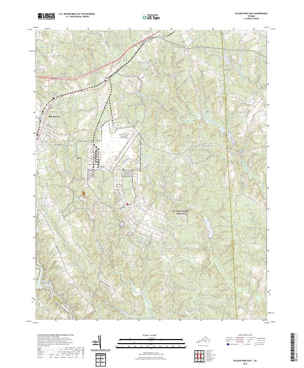
2022 Map of Blackstone East
USGS Topo · Published 2022About this map
Blackstone stands as the primary urban center in this contemporary survey of Nottoway County, which transitions from a structured municipal grid to the expansive military and educational grounds of the Allen C Perkinson Blackstone Army Airfield. The southeastern portion of the town gives way to the campus of Southside Virginia Community College, situated within the former Pickett Park area. This landscape is defined by its complex drainage network, where Hurricane Br and Birchin Creek feed into the southward-flowing Nottoway River. To the northeast, the recreation and conservation lands of Twin Lakes contrast with the technical and industrial layout of the airfield and its surrounding training roads. For those researching local heritage, the Spring Hill Baptist Church Cem offers a point of genealogical interest at the northern edge of the settlement.
Find a feature on this map
104 named features on this map. Tap any name to fly to it.
Don’t see what you’re looking for? This feature index may not catch every label — zoom into the map to look around manually.
Map Details
Editions of this 2022 Blackstone East Map
This is the sole edition of this map. No revisions or reprints were ever made.
Other maps of this area

1891 · Farmville
USGS Topo · 1:125,000

1893 · Farmville
USGS Topo · 1:125,000

1897 · Amelia
USGS Topo · 1:125,000

1918 · Lawrenceville
USGS Topo · 1:62,500

1920 · Lawrenceville
USGS Topo · 1:48,000

1921 · Lawrenceville
USGS Topo · 1:62,500

1942 · Lawrenceville
USGS Topo · 1:62,500

1943 · Richmond
USGS Topo · 1:250,000

1947 · Roanoke
USGS Topo · 1:250,000

1949 · Richmond
USGS Topo · 1:250,000