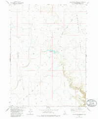
1979 Map of Blackstone Reservoir
USGS Topo · Published 1986About this map
Blackstone Ranch serves as a lone human outpost in this high-desert landscape of Owyhee County, situated along the edges of the Blackstone Desert. The area is defined by a series of intermittent drainage systems and rugged volcanic geography, where Louse Creek and Nit Creek carve through the plateau. Central to the map's water management is the Blackstone Reservoir, a vital resource for ranching operations in a region otherwise characterized by arid terrain like Big Holes and the remote reaches of Bighorn Country. Transport across this landscape is limited to the Blackstone Grasmere Road and a network of unimproved ways designated as Jeep Trails. The 1970s survey data reveals the sparse infrastructure of the era, including scattered Gravel Pits and the winding course of Juniper Draw, reflecting the isolation of southwestern Idaho's cattle country.
Find a feature on this map
11 named features on this map. Tap any name to fly to it.
Don’t see what you’re looking for? This feature index may not catch every label — zoom into the map to look around manually.
Map Details
Editions of this 1979 Blackstone Reservoir Map
2 editions found
Other maps of this area

1955 · Twin Falls
USGS Topo · 1:250,000

1956 · Big Hill
USGS Topo · 1:62,500

1956 · Winter Camp
USGS Topo · 1:62,500

1958 · Twin Falls
USGS Topo · 1:250,000

1979 · Indian Hot Springs
USGS Topo · 1:24,000

1979 · Blackstone Reservoir
USGS Topo · 1:24,000
1979 · Grasmere Reservoir
USGS Topo · 1:24,000

1979 · Cave Draw
USGS Topo · 1:24,000
1979 · Buster Butte
USGS Topo · 1:24,000
1979 · Grasmere
USGS Topo · 1:24,000