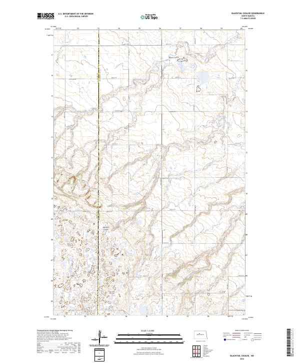
2024 Map of Blacktail Coulee
USGS Topo · Published 2024About this map
Blacktail Coulee defines the drainage pattern of this central North Dakota landscape, where the land falls away into deep coulees and prairie wetlands. The terrain is marked by a network of drainage features including Spring Creek and the Bowers Coulee, eventually feeding toward the Wintering River in the southeast. Conservation efforts are evident in the western portion of the map, specifically within the Ward County Waterfowl Production Area, which spans the boundary between Ward and McHenry counties. The rectilinear road grid, composed of local routes like Co Hwy 24 and 36th St N, highlights the persistent agricultural organization of the Great Plains. This topography shows the relationship between the elevated prairie plateau and the glacial meltwater channels that carved the coulee systems, shaping the land use and accessibility of the region.
Find a feature on this map
30 named features on this map. Tap any name to fly to it.
Don’t see what you’re looking for? This feature index may not catch every label — zoom into the map to look around manually.
Map Details
Editions of this 2024 Blacktail Coulee Map
This is the sole edition of this map. No revisions or reprints were ever made.
Other maps of this area

1929 · Sawyer
USGS Topo · 1:62,500

1929 · Benedict
USGS Topo · 1:62,500

1929 · Kongsberg
USGS Topo · 1:62,500

1948 · Voltaire
USGS Topo · 1:24,000

1948 · Velva
USGS Topo · 1:62,500

1948 · Sawyer
USGS Topo · 1:24,000

1949 · Sawyer
USGS Topo · 1:24,000

1949 · Velva
USGS Topo · 1:24,000

1949 · Voltaire
USGS Topo · 1:24,000

1949 · Sawyer
USGS Topo · 1:62,500