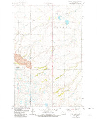
1981 Map of Blacktail Coulee
USGS Topo · Published 1982About this map
An Industrial Railroad cuts through the northern landscape of McHenry and Ward counties, reflecting the region's mid-century shift toward large-scale resource extraction. The southwestern quadrant is dominated by a substantial Strip Mine and Gravel Pit, industrial features that contrast with the conservation efforts seen at the National Waterfowl Production Area. This 1981 mapping captures a complex intersection of land uses, where drainage features like Blacktail Coulee and Woodliff Coulee traverse open territory marked by scattered rural infrastructure.
Find a feature on this map
17 named features on this map. Tap any name to fly to it.
Don’t see what you’re looking for? This feature index may not catch every label — zoom into the map to look around manually.
Map Details
Editions of this 1981 Blacktail Coulee Map
This is the sole edition of this map. No revisions or reprints were ever made.
Other maps of this area

1929 · Sawyer
USGS Topo · 1:62,500

1929 · Benedict
USGS Topo · 1:62,500

1929 · Kongsberg
USGS Topo · 1:62,500

1948 · Voltaire
USGS Topo · 1:24,000

1948 · Velva
USGS Topo · 1:62,500

1948 · Sawyer
USGS Topo · 1:24,000

1949 · Sawyer
USGS Topo · 1:24,000

1949 · Velva
USGS Topo · 1:24,000

1949 · Voltaire
USGS Topo · 1:24,000

1949 · Sawyer
USGS Topo · 1:62,500