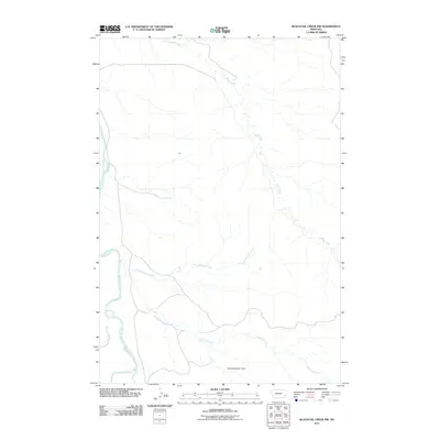
2011 Map of Blacktail Creek NW
USGS Topo · Published 2011About this map
The Powder River carves a winding course through this section of Carter County, shaping a landscape defined by an intricate network of drainage systems. The convergence of Blacktail Creek, Little Blacktail Creek, and Alkali Creek illustrates the complex natural irrigation of this Montana rangeland. In the lower portion of the quadrangle, the Mallett Number 2 Dam represents a specific point of water management, reflecting the practical human adaptations required for land use in this arid environment. The map provides a clear look at the meandering path of Nichols Creek as it feeds into the larger river system, offering a detailed record of the local topography and hydrology before modern changes might alter these seasonal watercourses.
Find a feature on this map
6 named features on this map. Tap any name to fly to it.
Don’t see what you’re looking for? This feature index may not catch every label — zoom into the map to look around manually.
Map Details
Editions of this 2011 Blacktail Creek NW Map
This is the sole edition of this map. No revisions or reprints were ever made.
Other maps of this area

1953 · Miles City
USGS Topo · 1:250,000

1954 · Ekalaka
USGS Topo · 1:250,000

1956 · Ekalaka
USGS Topo · 1:250,000

1957 · Miles City
USGS Topo · 1:250,000

1958 · Miles City
USGS Topo · 1:250,000

1958 · Ekalaka
USGS Topo · 1:250,000

1965 · Ekalaka
USGS Topo · 1:250,000

1969 · Tepee Butte
USGS Topo · 1:24,000

1979 · Blacktail Creek NW
USGS Topo · 1:24,000

1979 · Blacktail Creek SE
USGS Topo · 1:24,000