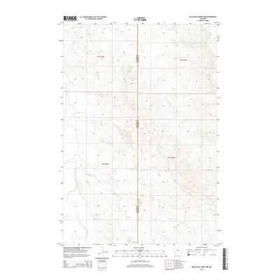
2014 Map of Blacktail Creek NW
USGS Topo · Published 2014About this map
The Powder River carves a winding path along the western edge of this territory, defining a landscape marked by its drainage systems and the historical dividing line between Custer and Carter counties. This 2014 survey by the U.S. Geological Survey details a remote section of Montana where the terrain is dominated by the erosion patterns of the Blacktail Cr and its northern counterpart, Little Blacktail Cr. The map captures the intricate network of coulees and breaks that feed into Alkali Cr, illustrating the rugged hydraulic geography of the northern Great Plains. These waterways are the primary landmarks in an area otherwise defined by township boundaries like t3n r54e and the absence of established settlements, reflecting the enduringly sparse population of the Montana rangeland.
Find a feature on this map
10 named features on this map. Tap any name to fly to it.
Don’t see what you’re looking for? This feature index may not catch every label — zoom into the map to look around manually.
Map Details
Editions of this 2014 Blacktail Creek NW Map
This is the sole edition of this map. No revisions or reprints were ever made.
Other maps of this area

1953 · Miles City
USGS Topo · 1:250,000

1954 · Ekalaka
USGS Topo · 1:250,000

1956 · Ekalaka
USGS Topo · 1:250,000

1957 · Miles City
USGS Topo · 1:250,000

1958 · Miles City
USGS Topo · 1:250,000

1958 · Ekalaka
USGS Topo · 1:250,000

1965 · Ekalaka
USGS Topo · 1:250,000

1969 · Tepee Butte
USGS Topo · 1:24,000

1979 · Blacktail Creek NW
USGS Topo · 1:24,000

1979 · Blacktail Creek SE
USGS Topo · 1:24,000