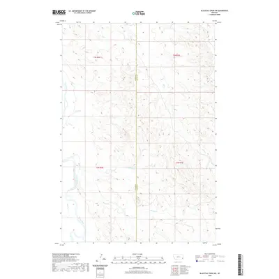
2020 Map of Blacktail Creek NW
USGS Topo · Published 2020About this map
The Powder River shapes the western edge of this landscape on the border of Carter and Custer counties. This high-plains terrain is defined by an intricate network of seasonal drainage systems, where Blacktail Cr and its northern counterpart, Little Blacktail Cr, carve through the topography toward the main river valley. Further north, the course of Alkali Cr marks the divide between these expansive ranchland townships. The map illustrates a strictly rural Montana environment, where the land is organized by the Public Land Survey System into townships t3n r54e and t2n r54e, reflecting a traditional western grid of ownership and management. While largely devoid of named settlements, the proximity of Nichols Cr to the river indicates the type of natural water sources that have historically dictated human activity in this arid region.
Find a feature on this map
10 named features on this map. Tap any name to fly to it.
Don’t see what you’re looking for? This feature index may not catch every label — zoom into the map to look around manually.
Map Details
Editions of this 2020 Blacktail Creek NW Map
This is the sole edition of this map. No revisions or reprints were ever made.
Other maps of this area

1953 · Miles City
USGS Topo · 1:250,000

1954 · Ekalaka
USGS Topo · 1:250,000

1956 · Ekalaka
USGS Topo · 1:250,000

1957 · Miles City
USGS Topo · 1:250,000

1958 · Miles City
USGS Topo · 1:250,000

1958 · Ekalaka
USGS Topo · 1:250,000

1965 · Ekalaka
USGS Topo · 1:250,000

1969 · Tepee Butte
USGS Topo · 1:24,000

1979 · Blacktail Creek NW
USGS Topo · 1:24,000

1979 · Blacktail Creek SE
USGS Topo · 1:24,000