
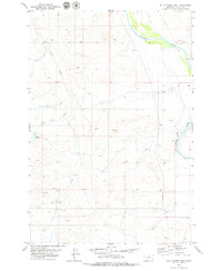
1979 Map of Blacktail Creek SW
USGS Topo · Published 1979About this map
Whitetail Creek and South Spring Creek flow through this remote corner of southeastern Montana, where the boundaries of Custer, Carter, and Powder River counties converge. The landscape is defined by the ephemeral drainage of Dry Creek and numerous smaller water sources simply labeled Spring. This 1979 survey captures the area’s ranching and resource-extraction character, noted by scattered Well sites and a Drill Hole located near a winding Jeep Trail. Transport through this rugged section of the northern plains is limited to the established Powderville Road, which traverses the southern portion of the quadrangle near the regional Base Line. The map provides a clear record of the section lines and township boundaries that partitioned this territory, serving as a primary source for researchers tracing land use and survey history in the borderlands of the Custer National Forest region.
Find a feature on this map
12 named features on this map. Tap any name to fly to it.
Don’t see what you’re looking for? This feature index may not catch every label — zoom into the map to look around manually.
Map Details
Editions of this 1979 Blacktail Creek SW Map
This is the sole edition of this map. No revisions or reprints were ever made.
Other maps of this area

1954 · Ekalaka
USGS Topo · 1:250,000

1956 · Ekalaka
USGS Topo · 1:250,000

1958 · Ekalaka
USGS Topo · 1:250,000

1965 · Ekalaka
USGS Topo · 1:250,000

1979 · Blacktail Creek NW
USGS Topo · 1:24,000

1979 · Blacktail Creek SE
USGS Topo · 1:24,000
1979 · Mills Creek East
USGS Topo · 1:24,000

1979 · Board Corral Creek
USGS Topo · 1:24,000

1979 · Powderville
USGS Topo · 1:24,000

1979 · Rattlesnake Ridge
USGS Topo · 1:24,000