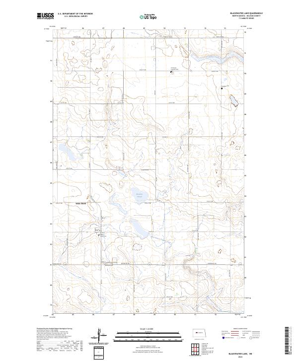
2024 Map of Blackwater Lake
USGS Topo · Published 2024About this map
White Shield and its surrounding prairie landscapes define this portion of McLean County, characterized by a mix of wetlands and agricultural tracts. The geography is marked by several significant conservation zones, including the McLean County Waterfowl Production Area, which protects the numerous sloughs and potholes typical of this region's glacial history. Water courses through the landscape via West Branch Douglas Creek and Glennon Coulee, while local heritage is preserved in the scattered rural burial grounds that serve the community. Genealogists and local historians will find several key landmarks for research, including the White Shield Cem, Immanuel Lutheran Cem, and Roseglen Cem. The network of section line roads, such as Country Rd 6 and Perimeter Rd, reflects the systematic land divisions that have organized these North Dakota plains for generations.
Find a feature on this map
24 named features on this map. Tap any name to fly to it.
Don’t see what you’re looking for? This feature index may not catch every label — zoom into the map to look around manually.
Map Details
Editions of this 2024 Blackwater Lake Map
This is the sole edition of this map. No revisions or reprints were ever made.
Other maps of this area

1954 · McClusky
USGS Topo · 1:250,000

1956 · Makoti SW
USGS Topo · 1:24,000

1956 · Blackwater Lake NW
USGS Topo · 1:24,000

1956 · Blackwater Lake
USGS Topo · 1:24,000

1956 · Blue Hill
USGS Topo · 1:24,000

1956 · Emmet
USGS Topo · 1:24,000

1956 · Roseglen
USGS Topo · 1:24,000

1958 · McClusky
USGS Topo · 1:250,000

1967 · Blackwater Lake SE
USGS Topo · 1:24,000

1967 · Blackwater Lake SW
USGS Topo · 1:24,000