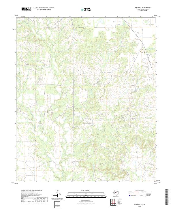
2022 Map of Blackwell NE
USGS Topo · Published 2022About this map
Decker Cem serves as a quiet local-history landmark on the plains of Nolan County, situated near the headwaters of Oak Cr. This landscape is defined by its drainage network, where the elevated terrain known as The Divide separates the northward flow of Bear Cr from the complex creek systems that branch across the quadrangle. Intermittent waterways like Pecan Cr, Cottonwood Cr, and Robertson Cr illustrate the watershed patterns of the West Texas ranchlands. The map details a strictly rural infrastructure, dominated by a grid of county roads such as Co RD 181 and Co RD 236 that connect the remote cattle country. This modern survey provides a clear view of the hydrological features and transport lines that have shaped the land's utility for generations.
Find a feature on this map
21 named features on this map. Tap any name to fly to it.
Don’t see what you’re looking for? This feature index may not catch every label — zoom into the map to look around manually.
Map Details
Editions of this 2022 Blackwell NE Map
This is the sole edition of this map. No revisions or reprints were ever made.
Other maps of this area

1893 · Sweetwater
USGS Topo · 1:125,000

1954 · Big Spring
USGS Topo · 1:250,000

1957 · Merkel
USGS Topo · 1:62,500

1958 · Big Spring
USGS Topo · 1:250,000

1967 · Hylton
USGS Topo · 1:24,000
1967 · Church Peak
USGS Topo · 1:24,000

1969 · Blackwell NE
USGS Topo · 1:24,000

1969 · Maryneal
USGS Topo · 1:24,000
1969 · Blackwell SW
USGS Topo · 1:24,000
1969 · Blackwell
USGS Topo · 1:24,000