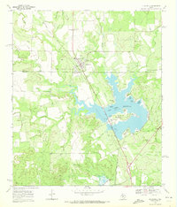
1969 Map of Blackwell
USGS Topo · Published 1972About this map
The town of Blackwell straddles the boundary between Nolan and Coke Counties, serving as a hub for the surrounding ranching and oil-producing landscape in the late 1960s. The Atchison Topeka and Santa Fe railroad runs through the center of the settlement, roughly paralleling the Aqueduct that feeds the expansive Oak Creek Reservoir. This body of water is characterized by intricate shoreline features like Gulf Peninsula, Humble Neck, and McDowell Point, indicating a managed water system critical for the region's industry and municipal needs. Rural life is anchored by family and community landmarks such as Blackwell Cem and Ross Cem. The terrain is marked by numerous Oil Wells and Gravel Pits, while natural drainage flows through Middle Kickapoo Creek and Eagle Creek toward the central reservoir.
Find a feature on this map
38 named features on this map. Tap any name to fly to it.
Don’t see what you’re looking for? This feature index may not catch every label — zoom into the map to look around manually.
Map Details
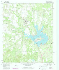
Editions of this 1969 Blackwell Map
2 editions found
Other maps of this area

1891 · Hayrick
USGS Topo · 1:125,000

1893 · Sweetwater
USGS Topo · 1:125,000

1894 · Hayrick
USGS Topo · 1:125,000

1921 · Bronte
USGS Topo · 1:31,680

1954 · Big Spring
USGS Topo · 1:250,000

1954 · San Angelo
USGS Topo · 1:250,000

1958 · San Angelo
USGS Topo · 1:250,000

1958 · Big Spring
USGS Topo · 1:250,000
1961 · Hog Mountain
USGS Topo · 1:24,000
1961 · Bronte
USGS Topo · 1:24,000