
1939 Map of Bladen
USGS Topo · Published 1939About this map
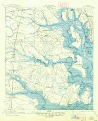
Colonels Island and the meandering waterways of the Turtle River and Little Satilla River dominate this coastal Georgia landscape, where the tides dictate the geography of numerous islands like Rough Island, Blythe Island, and Hogans I. This 1939 edition, based on earlier surveys, captures a transition in the local economy from river-reliant transport to a robust rail network. The Atlantic Coast Line, Seaboard Air Line, and Southern railroads intersect at points like Bladen and Southern Junc, connecting the rural interior to the Southern Ry Docks. Evidence of local community life is visible in the distribution of rural education at the Magnolia School, Buck Swamp School, and Brockington School. The geography is defined by an intricate system of naming, from the Waverly Tramroad used for timber transport to the many named wetlands like Tiger Swamp and Hardy Swamp.
Find a feature on this map
80 named features on this map. Tap any name to fly to it.
Don’t see what you’re looking for? This feature index may not catch every label — zoom into the map to look around manually.
Map Details
Editions of this 1939 Bladen Map
2 editions found
Other maps of this area

1917 · Nahunta
USGS Topo · 1:62,500

1917 · Boulogne
USGS Topo · 1:62,500

1918 · Cumberland Island
USGS Topo · 1:62,500

1918 · Hortense
USGS Topo · 1:62,500

1918 · Everett City
USGS Topo · 1:62,500

1918 · Nahunta
USGS Topo · 1:62,500

1918 · Bladen
USGS Topo · 1:62,500

1918 · Kingsland
USGS Topo · 1:62,500

1919 · Boulogne
USGS Topo · 1:62,500

1920 · Everett City
USGS Topo · 1:62,500