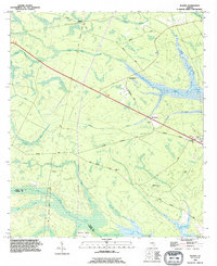
1993 Map of Bladen
USGS Topo · Published 1995About this map
Turtle River and its dense network of tidal marshes define the eastern edge of this landscape on the border of Glynn and Camden Counties. The settlement at Brookman serves as a central junction where local life revolves around landmarks like the Brookman Cemetery and the Lookout Tower. Further north, the old railroad crossroads at Bladen features a Flowing Well and an Old Railroad Grade, marking the remains of early transportation corridors through the wetlands. The map provides significant genealogical value through its documentation of rural family and community sites, including the Higginbotham Cemetery and Mack Cemetery located near Buck Swamp. Small religious hubs such as New Zion Church and Magnolia Church appear alongside established routes like the Massie Causeway, illustrating the historical connectivity of these coastal Georgia communities.
Find a feature on this map
42 named features on this map. Tap any name to fly to it.
Don’t see what you’re looking for? This feature index may not catch every label — zoom into the map to look around manually.
Map Details
Editions of this 1993 Bladen Map
This is the sole edition of this map. No revisions or reprints were ever made.
Other maps of this area

1917 · Nahunta
USGS Topo · 1:62,500

1918 · Hortense
USGS Topo · 1:62,500

1918 · Everett City
USGS Topo · 1:62,500

1918 · Nahunta
USGS Topo · 1:62,500

1918 · Bladen
USGS Topo · 1:62,500

1920 · Everett City
USGS Topo · 1:62,500

1939 · Bladen
USGS Topo · 1:62,500

1944 · Everett City
USGS Topo · 1:62,500

1944 · Hortense
USGS Topo · 1:62,500

1946 · Brunswick
USGS Topo · 1:250,000