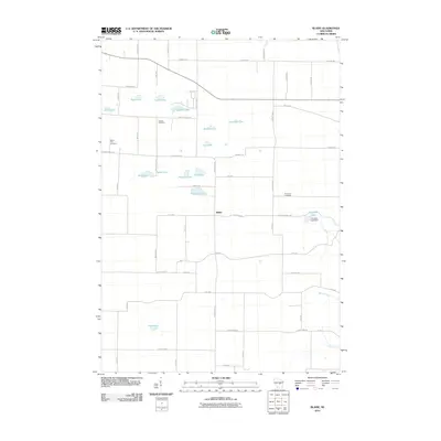
2010 Map of Blaine
USGS Topo · Published 2010About this map
The settlement of Blaine serves as the focal point for this Portage County landscape, where a dense cluster of glacial kettle lakes defines the geography. Names like Boelter Lake, Huntleys Lake, and Wolf Lake suggest early settler family holdings, while the Fountain Lake Dam on Emmons Creek indicates a managed water system in the eastern portion of the quadrangle. The township's rural character is underscored by several dedicated burial grounds, including Hillside Cemetery and Buena Vista Cemetery, which provide vital touchstones for local genealogical research.
Find a feature on this map
58 named features on this map. Tap any name to fly to it.
Don’t see what you’re looking for? This feature index may not catch every label — zoom into the map to look around manually.
Map Details
Editions of this 2010 Blaine Map
This is the sole edition of this map. No revisions or reprints were ever made.
Other maps of this area

1955 · Green Bay
USGS Topo · 1:250,000

1957 · Amherst
USGS Topo · 1:48,000

1957 · Waupaca
USGS Topo · 1:48,000

1959 · Wautoma
USGS Topo · 1:48,000

1961 · Redgranite
USGS Topo · 1:62,500

1961 · Wild Rose
USGS Topo · 1:24,000

1968 · Plainfield
USGS Topo · 1:24,000
1968 · Wautoma NE
USGS Topo · 1:24,000
1969 · King
USGS Topo · 1:24,000
1969 · Blaine
USGS Topo · 1:24,000