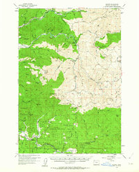
1955 Map of Blaine
USGS Topo · Published 1964About this map
Blaine and the surrounding timberlands of the Siuslaw National Forest define this mid-1950s landscape in Tillamook County. The map details a rugged interior dominated by the drainage basins of the Trask River and the Wilson River. Evidence of a working forest and local community is visible through features like the Nestucca Grange Hall and the Trask Guard Station. Remnants of early transportation routes, including the Old Toll Road and Chance Road, cross the ridges between peaks like Edwards Butte and Ginger Peak. Higher elevations are marked by remote installations such as a Lookout on Hembre Ridge. Smaller enclaves and clearings, such as Hollywood Camp, The Peninsula, and Detrick Ranch, provide specific points of interest for genealogists tracing families in the Oregon Coast Range before more modern development altered these rural corridors.
Find a feature on this map
83 named features on this map. Tap any name to fly to it.
Don’t see what you’re looking for? This feature index may not catch every label — zoom into the map to look around manually.
Map Details
Editions of this 1955 Blaine Map
2 editions found

Other maps of this area

1937 · Nehalem
USGS Topo · 1:62,500

1937 · Enright
USGS Topo · 1:62,500

1941 · Nestucca Bay
USGS Topo · 1:62,500

1941 · Timber
USGS Topo · 1:62,500

1941 · Enright
USGS Topo · 1:62,500

1942 · Ginger Peak
USGS Topo · 1:62,500

1942 · Sheridan
USGS Topo · 1:62,500

1942 · Spirit Mtn
USGS Topo · 1:62,500

1942 · Nestucca Bay
USGS Topo · 1:62,500

1942 · Fairdale
USGS Topo · 1:62,500