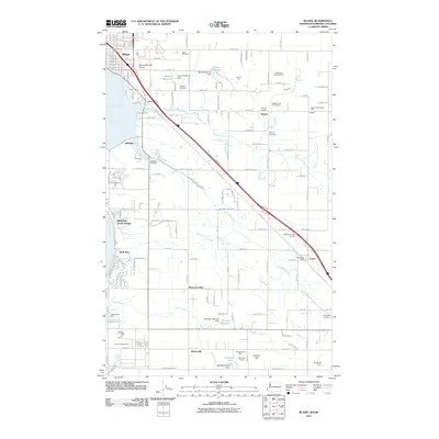
2011 Map of Blaine
USGS Topo · Published 2011About this map
Blaine sits at the northern edge of this coastal landscape, situated where the Canadian border meets the waters of Drayton Harbor. The area's mid-century growth is evidenced by a network of rural communities such as Hillsdale, Haynie, and Custer, each connected by a grid of named roads like H Street Rd and Loomis Trail Rd. Water management is a defining characteristic of the terrain, with several engineered structures including Olason Reservoir Dam and Smrekar Reservoir Dam regulating local drainages like Dakota Creek and California Creek.
Find a feature on this map
157 named features on this map. Tap any name to fly to it.
Don’t see what you’re looking for? This feature index may not catch every label — zoom into the map to look around manually.
Map Details
Editions of this 2011 Blaine Map
This is the sole edition of this map. No revisions or reprints were ever made.
Other maps of this area

1907 · Blaine
USGS Topo · 1:62,500

1952 · Bertrand Creek
USGS Topo · 1:24,000

1952 · Birch Point
USGS Topo · 1:24,000

1952 · Ferndale
USGS Topo · 1:24,000

1952 · Lummi Bay
USGS Topo · 1:24,000

1952 · Blaine
USGS Topo · 1:24,000

1952 · Blaine
USGS Topo · 1:62,500

1957 · Victoria
USGS Topo · 1:250,000

1975 · Bellingham
USGS Topo · 1:100,000
1997 · Lummi Bay
USGS Topo · 1:24,000