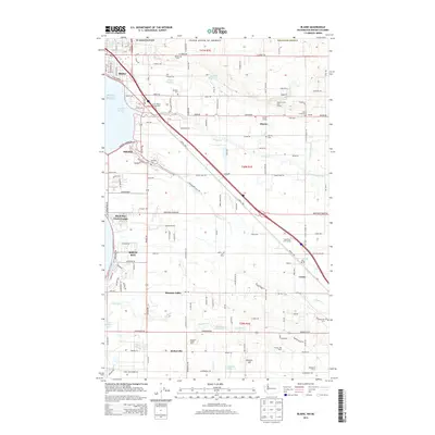
2014 Map of Blaine
USGS Topo · Published 2014About this map
Blaine sits at the northwestern edge of this landscape, where the Washington United States of America border meets Puget Sound and the protected waters of Drayton Harbor. The region is defined by a dense network of dairy farms and rural infrastructure, including Paul Dairy, A A Dairy, and Family Hill Dairy, alongside community hubs like the Haynie Community Hall and Haynie Grange. Transportation routes like Portal Way and Blaine Rd connect established settlements such as Custer, Haynie, and Birch Bay. Local history and genealogy are anchored by several notable burial grounds, including Blaine Cem, Kulshan Cem, and Enterprise Cem. The landscape is carved by numerous watercourses, most notably Dakota Creek and California Creek, which flow toward the sound through a patchwork of agricultural fields and recreational spaces like the Dakota Creek Golf Course and Grandview Golf Course.
Find a feature on this map
148 named features on this map. Tap any name to fly to it.
Don’t see what you’re looking for? This feature index may not catch every label — zoom into the map to look around manually.
Map Details
Editions of this 2014 Blaine Map
This is the sole edition of this map. No revisions or reprints were ever made.
Other maps of this area

1907 · Blaine
USGS Topo · 1:62,500

1952 · Bertrand Creek
USGS Topo · 1:24,000

1952 · Birch Point
USGS Topo · 1:24,000

1952 · Ferndale
USGS Topo · 1:24,000

1952 · Lummi Bay
USGS Topo · 1:24,000

1952 · Blaine
USGS Topo · 1:24,000

1952 · Blaine
USGS Topo · 1:62,500

1957 · Victoria
USGS Topo · 1:250,000

1975 · Bellingham
USGS Topo · 1:100,000
1997 · Lummi Bay
USGS Topo · 1:24,000