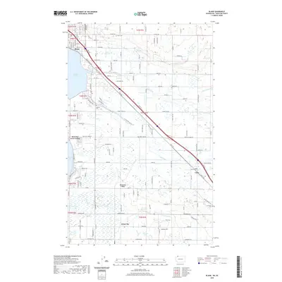
2020 Map of Blaine
USGS Topo · Published 2020About this map
Blaine sits at the northern edge of this Washington coastal landscape, where Drayton Harbor meets the winding paths of Dakota Creek and California Creek. The region is defined by its rural density, featuring several established burial grounds such as Blaine Cem, Haynie Cem, and Hillsdale Cem, which serve as vital points of interest for local genealogy. Further south, the community of Custer marks a key intersection near the small settlements of Pleasant Valley and Kickerville.
Find a feature on this map
125 named features on this map. Tap any name to fly to it.
Don’t see what you’re looking for? This feature index may not catch every label — zoom into the map to look around manually.
Map Details
Editions of this 2020 Blaine Map
This is the sole edition of this map. No revisions or reprints were ever made.
Other maps of this area

1907 · Blaine
USGS Topo · 1:62,500

1952 · Bertrand Creek
USGS Topo · 1:24,000

1952 · Birch Point
USGS Topo · 1:24,000

1952 · Ferndale
USGS Topo · 1:24,000

1952 · Lummi Bay
USGS Topo · 1:24,000

1952 · Blaine
USGS Topo · 1:24,000

1952 · Blaine
USGS Topo · 1:62,500

1957 · Victoria
USGS Topo · 1:250,000

1975 · Bellingham
USGS Topo · 1:100,000
1997 · Lummi Bay
USGS Topo · 1:24,000