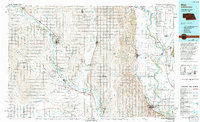
1986 Map of Blair
USGS Topo · Published 1994About this map
The Missouri River and Elkhorn River define the agricultural landscape of this eastern Nebraska and western Iowa border region in the mid-1980s. The wide, meandering river valleys support a network of small grain-handling towns and rail connections, including the Chicago and North Western line serving communities like West Point and Scribner. Significant riparian conservation areas dot the river corridors, most notably the De Soto National Wildlife Refuge and the Dead Timber State Recreation Area. Large oxbow lakes such as Lake Quinnebaugh and De Soto Lake remain as footprints of the Missouri's shifting course before modern channelization. Settlement patterns are dense with small villages like Uehling, Herman, and Hooper, which are linked by a grid of rural roads that cross numerous tributaries including Logan Creek and Maple Creek.
Find a feature on this map
84 named features on this map. Tap any name to fly to it.
Don’t see what you’re looking for? This feature index may not catch every label — zoom into the map to look around manually.
Map Details
Editions of this 1986 Blair Map
2 editions found
Other maps of this area

1893 · Omaha
USGS Topo · 1:62,500

1893 · Fremont
USGS Topo · 1:125,000

1896 · Fremont
USGS Topo · 1:125,000

1899 · Wahoo
USGS Topo · 1:125,000

1899 · David City
USGS Topo · 1:125,000

1954 · Omaha
USGS Topo · 1:250,000

1954 · Fort Dodge
USGS Topo · 1:250,000

1955 · Sioux City
USGS Topo · 1:250,000

1955 · Fremont
USGS Topo · 1:250,000

1957 · Fremont
USGS Topo · 1:250,000