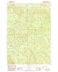
1986 Map of Blair Lake
USGS Topo · Published 1986About this map
Willamette National Forest encompasses this high-elevation landscape in Lane County, where the topography is defined by the headwaters of the North Fork Willamette River and the Middle Fork Willamette River. The area is characterized by a series of distinct high-mountain meadows and prairies, including Blair Meadows, Spring Prairie, and Fisher Prairie, which likely served as important seasonal landmarks for early resource management and recreation. The 1980s landscape reveals an active industrial footprint within the wilderness, specifically tied to road building and forest maintenance as evidenced by numerous Quarries and the Salmon Quarry. Water systems are intricate here, with many named drainages such as Salmon Creek and Black Creek feeding the larger river forks. Notable peaks like Mule Mountain and Koch Mountain provide prominent vertical relief in this densely wooded sector of the Cascades.
Find a feature on this map
41 named features on this map. Tap any name to fly to it.
Don’t see what you’re looking for? This feature index may not catch every label — zoom into the map to look around manually.
Map Details
Editions of this 1986 Blair Lake Map
This is the sole edition of this map. No revisions or reprints were ever made.
Other maps of this area

1925 · Waldo Lake
USGS Topo · 1:125,000

1955 · Chucksney Mtn
USGS Topo · 1:62,500

1956 · Waldo Lake
USGS Topo · 1:62,500

1956 · Oakridge
USGS Topo · 1:62,500

1956 · Sardine Butte
USGS Topo · 1:62,500

1958 · Roseburg
USGS Topo · 1:250,000

1959 · Roseburg
USGS Topo · 1:250,000

1983 · Oakridge
USGS Topo · 1:100,000
1986 · Mc Credie Springs
USGS Topo · 1:24,000
1986 · Chucksney Mountain
USGS Topo · 1:24,000