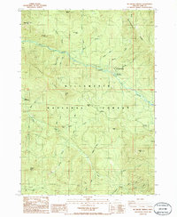
1986 Map of Mc Credie Springs
USGS Topo · Published 1986About this map
Salt Creek serves as the central corridor for this 1980s mountain survey, carving a path through the Willamette National Forest in Lane County. The area is defined by its hydrothermal activity and recreational infrastructure, notably around the settlement of McCredie Springs. Here, the proximity of McCredie Hot Springs and the Blue Pool Campground highlights the region's long-standing draw for travelers and outdoor enthusiasts. Further west, Kitson Hot Springs sits at the base of Kitson Ridge, marking another significant geothermal landmark.
Find a feature on this map
46 named features on this map. Tap any name to fly to it.
Don’t see what you’re looking for? This feature index may not catch every label — zoom into the map to look around manually.
Map Details
Editions of this 1986 Mc Credie Springs Map
This is the sole edition of this map. No revisions or reprints were ever made.
Other maps of this area

1925 · Waldo Lake
USGS Topo · 1:125,000

1955 · Chucksney Mtn
USGS Topo · 1:62,500

1956 · Waldo Lake
USGS Topo · 1:62,500

1956 · Oakridge
USGS Topo · 1:62,500

1956 · Sardine Butte
USGS Topo · 1:62,500

1958 · Roseburg
USGS Topo · 1:250,000

1959 · Roseburg
USGS Topo · 1:250,000

1983 · Oakridge
USGS Topo · 1:100,000
1986 · Groundhog Mountain
USGS Topo · 1:24,000
1986 · Warner Mountain
USGS Topo · 1:24,000