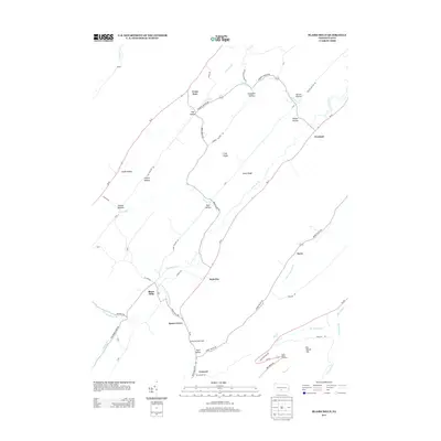
2013 Map of Blairs Mills
USGS Topo · Published 2013About this map
Tuscarora Cr defines the valley floor in this 2013 survey, where small settlements like Blairs Mills and Waterloo are connected by a network of rural routes including Pa-75. The landscape is shaped by long parallel ridges, with Grey Ridge and Creek Ridge separating the primary drainages. Many of the small communities, including Concord, Concord Narrows, and Spears Grove, are positioned along the narrow valley floors, reflecting a settlement pattern dictated by the steep topography of Path Valley and the surrounding hollows. In the southern portion of the quadrangle, Big Spring and the Burns Valley Overlook highlight the transition toward more protected lands, including the State Forestry Rd. This detailed mapping records the modern footprints of historic locales such as Perulack and Cross Keys, providing a precise look at the rural landscape and its enduring watercourses like Horse Valley Run.
Find a feature on this map
65 named features on this map. Tap any name to fly to it.
Don’t see what you’re looking for? This feature index may not catch every label — zoom into the map to look around manually.
Map Details
Editions of this 2013 Blairs Mills Map
This is the sole edition of this map. No revisions or reprints were ever made.
Other maps of this area

1919 · Mattawana
USGS Topo · 1:62,500

1922 · Mt Union
USGS Topo · 1:48,000

1923 · Shippensburg
USGS Topo · 1:62,500

1924 · Mt. Union
USGS Topo · 1:62,500

1936 · East Waterford
USGS Topo · 1:48,000

1939 · Orbisonia
USGS Topo · 1:62,500

1940 · Orbisonia
USGS Topo · 1:62,500

1941 · East Waterford
USGS Topo · 1:62,500

1943 · Shippensburg
USGS Topo · 1:62,500

1944 · Orbisonia
USGS Topo · 1:62,500
Featured Places
- Perulack, Lack Township
- Blairs Mills, Tell Township
- Seyoc, Toboyne Township
- Cross Keys, Lack Township
- Lack Township, PA