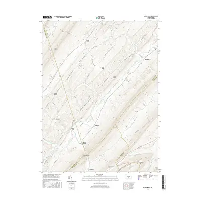
2016 Map of Blairs Mills
USGS Topo · Published 2016About this map
Tuscarora Mountain and Shade Mountain define the parallel ridgelines of this section of the Ridge-and-Valley Appalachians, framing a series of narrow agricultural and residential corridors. Central to the landscape is the winding course of Tuscarora Creek, which passes through the Concord Narrows and anchors several small communities, including Blairs Mills, Waterloo, and Peru Mills. The map reveals a high density of family and community burial sites, from the McWilliams Cem in the northeast to the remote McCaskey Graves near Big Round Top. Settlement patterns are strictly dictated by the terrain, with roads like Hog Hollow Rd and Shearer Hollow Rd tracing the gaps and valleys between steep ridges. This 2016 survey documents the enduring rural character of the borderlands between Juniata, Perry, Huntingdon, and Franklin counties, where traditional place names like Spears Grove and Cross Keys persist.
Find a feature on this map
81 named features on this map. Tap any name to fly to it.
Don’t see what you’re looking for? This feature index may not catch every label — zoom into the map to look around manually.
Map Details
Editions of this 2016 Blairs Mills Map
This is the sole edition of this map. No revisions or reprints were ever made.
Other maps of this area

1919 · Mattawana
USGS Topo · 1:62,500

1922 · Mt Union
USGS Topo · 1:48,000

1923 · Shippensburg
USGS Topo · 1:62,500

1924 · Mt. Union
USGS Topo · 1:62,500

1936 · East Waterford
USGS Topo · 1:48,000

1939 · Orbisonia
USGS Topo · 1:62,500

1940 · Orbisonia
USGS Topo · 1:62,500

1941 · East Waterford
USGS Topo · 1:62,500

1943 · Shippensburg
USGS Topo · 1:62,500

1944 · Orbisonia
USGS Topo · 1:62,500
Featured Places
- Perulack, Lack Township
- Blairs Mills, Tell Township
- Seyoc, Toboyne Township
- Cross Keys, Lack Township
- Lack Township, PA