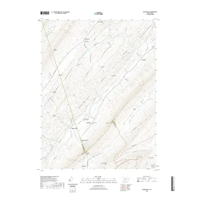
2019 Map of Blairs Mills
USGS Topo · Published 2019About this map
Tuscarora Creek flows through a series of steep, parallel ridges including Tuscarora Mtn and Shade Mountain, defining the settlement patterns of this central Pennsylvania landscape. Historically significant as a meeting point for three counties—Juniata, Perry, and Franklin—the area contains a cluster of rural hamlets such as Blairs Mills, Waterloo, and Concord. These communities are anchored by numerous small burial grounds and places of worship, including the Upper Tuscarora Presbyterian Cem and Mount Zion Church Cem. The terrain is marked by distinct hollows like Hog Hollow and Rhines Hollow, which limited early road development to the valley floors. Genealogists can find evidence of early families through landmarks like the McCaskey Graves and McWilliams Cem located near Perulack, reflecting the long-established agricultural and rural identity of the region.
Find a feature on this map
85 named features on this map. Tap any name to fly to it.
Don’t see what you’re looking for? This feature index may not catch every label — zoom into the map to look around manually.
Map Details
Editions of this 2019 Blairs Mills Map
This is the sole edition of this map. No revisions or reprints were ever made.
Other maps of this area

1919 · Mattawana
USGS Topo · 1:62,500

1922 · Mt Union
USGS Topo · 1:48,000

1923 · Shippensburg
USGS Topo · 1:62,500

1924 · Mt. Union
USGS Topo · 1:62,500

1936 · East Waterford
USGS Topo · 1:48,000

1939 · Orbisonia
USGS Topo · 1:62,500

1940 · Orbisonia
USGS Topo · 1:62,500

1941 · East Waterford
USGS Topo · 1:62,500

1943 · Shippensburg
USGS Topo · 1:62,500

1944 · Orbisonia
USGS Topo · 1:62,500
Featured Places
- Perulack, Lack Township
- Blairs Mills, Tell Township
- Seyoc, Toboyne Township
- Cross Keys, Lack Township
- Lack Township, PA