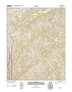
2013 Map of Blairs
USGS Topo · Published 2013About this map
The community of Blairs and the northern outskirts of Danville define the southwestern corner of this survey, where residential development meets the rural expanses of Pittsylvania County. This landscape is characterized by a dense network of country lanes and creeks that drain toward the Dan River basin. Small rural centers such as Keeling and Kentuck are established at key road intersections, serving as historical anchors for the surrounding farmland.
Find a feature on this map
100 named features on this map. Tap any name to fly to it.
Don’t see what you’re looking for? This feature index may not catch every label — zoom into the map to look around manually.
Map Details
Editions of this 2013 Blairs Map
This is the sole edition of this map. No revisions or reprints were ever made.
Other maps of this area

1921 · Chatham
USGS Topo · 1:48,000

1923 · Danville
USGS Topo · 1:48,000

1923 · Chatham
USGS Topo · 1:62,500

1925 · Danville
USGS Topo · 1:62,500

1952 · Milton
USGS Topo · 1:62,500

1953 · Greensboro
USGS Topo · 1:250,000

1954 · Greensboro
USGS Topo · 1:250,000

1954 · Riceville
USGS Topo · 1:62,500

1956 · Milton
USGS Topo · 1:62,500

1962 · Greensboro
USGS Topo · 1:250,000