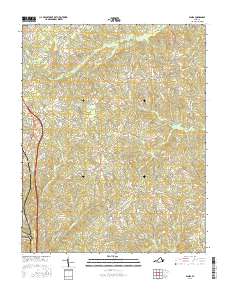
2016 Map of Blairs
USGS Topo · Published 2016About this map
Blairs and Keeling anchor this northern Pittsylvania County landscape, illustrating the modern rural character of south-central Virginia. The terrain is defined by a dense network of small watercourses, including Birch Cr, Sandy Cr, and Lawless Cr, which flow through the dissected uplands. Settlement is concentrated along the primary road corridors, with Beaver Park and Kentuck serving as local nodes between the agricultural tracts and the northern reaches of Danville.
Find a feature on this map
85 named features on this map. Tap any name to fly to it.
Don’t see what you’re looking for? This feature index may not catch every label — zoom into the map to look around manually.
Map Details
Editions of this 2016 Blairs Map
This is the sole edition of this map. No revisions or reprints were ever made.
Other maps of this area

1921 · Chatham
USGS Topo · 1:48,000

1923 · Danville
USGS Topo · 1:48,000

1923 · Chatham
USGS Topo · 1:62,500

1925 · Danville
USGS Topo · 1:62,500

1952 · Milton
USGS Topo · 1:62,500

1953 · Greensboro
USGS Topo · 1:250,000

1954 · Greensboro
USGS Topo · 1:250,000

1954 · Riceville
USGS Topo · 1:62,500

1956 · Milton
USGS Topo · 1:62,500

1962 · Greensboro
USGS Topo · 1:250,000