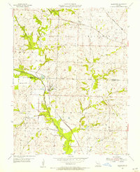
1955 Map of Blairstown
USGS Topo · Published 1956About this map
The railroad junction at Blairstown serves as a focal point for this mid-century survey of the Henry and Johnson County line. Three major rail corridors—the Chicago Rock Island and Pacific, Missouri Kansas Texas, and St Louis San Francisco—crisscross the landscape, illustrating the region's importance as a transportation hub for agricultural and mineral transport. The terrain is defined by the winding course of Big Creek and its many tributaries, including Norris Creek and White Oak Cr, where a system of levees protects the bottomlands.
Find a feature on this map
26 named features on this map. Tap any name to fly to it.
Don’t see what you’re looking for? This feature index may not catch every label — zoom into the map to look around manually.
Map Details
Editions of this 1955 Blairstown Map
This is the sole edition of this map. No revisions or reprints were ever made.
Other maps of this area

1885 · Warrensburg
USGS Topo · 1:125,000

1887 · Clinton
USGS Topo · 1:125,000

1887 · Harrisonville
USGS Topo · 1:125,000

1887 · Butler
USGS Topo · 1:125,000

1887 · Warrensburg
USGS Topo · 1:125,000

1892 · Harrisonville
USGS Topo · 1:125,000

1894 · Harrisonville
USGS Topo · 1:125,000

1894 · Butler
USGS Topo · 1:125,000

1894 · Warrensburg
USGS Topo · 1:125,000

1894 · Clinton
USGS Topo · 1:125,000