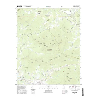
2017 Map of Blairsville
USGS Topo · Published 2017About this map
Blairsville serves as a central hub in this high-altitude landscape where the Chattahoochee National Forest and Nantahala National Forest meet at the Georgia-North Carolina border. The terrain is defined by a dense network of mountain gaps and coves, such as Tarkiln Cove and Beegum Gap, which historically dictated the paths of travel and settlement. Water resources are abundant, ranging from the expansive Nottely Lake in the southwest to the intricate drainages of Gumlog Cr and Brasstown Creek. Local history and genealogy are well-represented by numerous family and community sites, including Gumlog Cem, Blairsville Cem, and Ebenezer Cem. The transition from rural crossroad settlements like Youngstown and Pinelog Village to the protected forest lands illustrates the region's long-standing balance between mountain agriculture and federal wilderness preservation.
Find a feature on this map
175 named features on this map. Tap any name to fly to it.
Don’t see what you’re looking for? This feature index may not catch every label — zoom into the map to look around manually.
Map Details
Editions of this 2017 Blairsville Map
This is the sole edition of this map. No revisions or reprints were ever made.
Other maps of this area

1886 · Dahlonega
USGS Topo · 1:125,000

1888 · Ellijay
USGS Topo · 1:125,000

1892 · Dahlonega
USGS Topo · 1:125,000

1892 · Ellijay
USGS Topo · 1:125,000

1893 · Murphy
USGS Topo · 1:125,000

1896 · Dahlonega
USGS Topo · 1:125,000

1898 · Ellijay
USGS Topo · 1:125,000

1903 · Dahlonega
USGS Topo · 1:125,000

1911 · Ellijay
USGS Topo · 1:125,000

1914 · Murphy
USGS Topo · 1:125,000