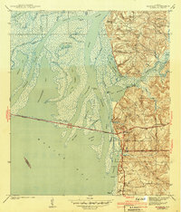
1943 Map of Blakeley
USGS Topo · Published 1943About this map
Civil War Trenches and Kings Battery define the high ground overlooking the Mobile River delta in this 1939 survey. The area around Blakeley serves as a stark historical focal point, where the terrain transitions from the convoluted marshes of Blakeley Island to the prominent heights of Humpback Ridge. The map captures a moment when the Spanish Trail and the Cochrane Bridge provided the primary automotive artery across the complex waterway network of the Tensaw River and Apalachee River. Local industry and river access are evident through numerous small landings like Sibley Ldg and Johns Ldg tucked along Minette Bay. Small settlements such as Bridgehead and Park City sit at the edge of the wetlands, illustrating the balance between the burgeoning coastal development and the challenging geography of the Mobile Bay headwaters.
Find a feature on this map
63 named features on this map. Tap any name to fly to it.
Don’t see what you’re looking for? This feature index may not catch every label — zoom into the map to look around manually.
Map Details
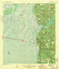
Editions of this 1943 Blakeley Map
2 editions found
Other maps of this area

1921 · Fairhope
USGS Topo · 1:62,500

1922 · Mobile
USGS Topo · 1:62,500

1939 · Daphne
USGS Topo · 1:31,680

1940 · Silverhill
USGS Topo · 1:31,680

1940 · Hollingers Island
USGS Topo · 1:31,680

1940 · Mobile
USGS Topo · 1:31,680

1940 · Mobile
USGS Topo · 1:62,500

1941 · Chickasaw
USGS Topo · 1:31,680

1941 · Daphne
USGS Topo · 1:31,680

1941 · Silverhill
USGS Topo · 1:31,680