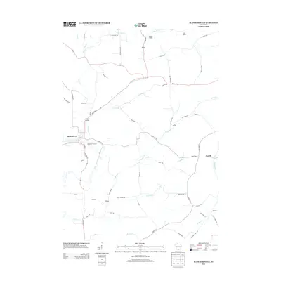
2013 Map of Blanchardville
USGS Topo · Published 2013About this map
The East Br Pecatonica River winds through this landscape, anchoring the village of Blanchardville and its surrounding agricultural terrain in the early 21st century. The map reveals a deeply etched valley system, where named features like Jeglum Valley, Step Valley, and Hay Hollow follow the drainage of local tributaries such as Sawmill Cr and Erickson Cr. These valleys dictate the placement of rural corridors like Hay Hollow Rd and Drammen Valley Rd, showing how the physical geography continues to shape movement in this corner of Wisconsin.
Find a feature on this map
59 named features on this map. Tap any name to fly to it.
Don’t see what you’re looking for? This feature index may not catch every label — zoom into the map to look around manually.
Map Details
Editions of this 2013 Blanchardville Map
This is the sole edition of this map. No revisions or reprints were ever made.
Other maps of this area

1920 · Monroe
USGS Topo · 1:62,500

1922 · Monroe
USGS Topo · 1:62,500

1923 · Blanchardville
USGS Topo · 1:62,500

1923 · New Glarus
USGS Topo · 1:62,500

1923 · South Wayne
USGS Topo · 1:62,500

1954 · Rockford
USGS Topo · 1:250,000

1955 · Rockford
USGS Topo · 1:250,000

1958 · Rockford
USGS Topo · 1:250,000
1962 · New Glarus
USGS Topo · 1:62,500
1962 · Monroe NW
USGS Topo · 1:24,000